data quality
Melissa Acquires ZipInfo.com
Longtime provider of ZIP code databases and software developer kits aligns strategically with Melissa’s global address expertise and customer base...
Mark your calendars and set your alarms because a spectacular celestial event is heading our way on April 8th, 2024 - a total solar eclipse! But what exactly is a solar eclipse, and how can you catch this phenomenon? Don't worry; Melissa has you covered with all the information you need, including some exciting insights from our GIS team's StoryMap.
What is a Solar Eclipse?
A solar eclipse occurs when the Moon passes between the Earth and the Sun, blocking all or part of the Sun's light. It's like nature's own magic trick, turning day into an eerie twilight for those lucky enough to be in the path of totality.
When and Where Can You See It?
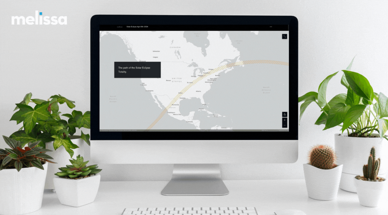
The total solar eclipse will be visible across North America, starting in Mazatlán, Mexico, at 11:07 a.m. MST and ending in Catalina, Newfoundland, Canada, at 5:13 p.m. NDT. It will traverse through 15 U.S. States and several Mexican cities, offering millions of people the chance to witness this rare spectacle.
If you're outside the path of totality, don't worry! You can still catch a partial solar eclipse, with varying percentages of the Sun covered depending on your location. For example, Los Angeles will experience 49% coverage and San Diego will experience 54% coverage, while San Antonio will see a staggering 99.9%!
How to View Safely
Now, here's the crucial part: never look directly at the Sun without proper eye protection. During the partial phases, you must wear solar eclipse glasses, and if you're lucky enough to be in the path of totality, you can briefly remove them to witness the Sun's corona. Telescopes, binoculars, and cameras also need solar filters to prevent damage to your eyes or equipment.
Introducing the Solar Eclipse StoryMap by Melissa’s GIS Team
Now, let's dive into something truly fascinating - our GIS team's Solar Eclipse StoryMap! This interactive map powered by Esri, not only tracks the path of the eclipse but also provides detailed data insights for various regions along the way. Here's a sneak peek into what you can expect:
The StoryMap not only enriches your eclipse viewing experience but also showcases the power of geographic information systems (GIS) in visualizing complex data in a user-friendly manner.
So, whether you're a seasoned eclipse enthusiast or a curious bystander, don't miss out on this once-in-a-lifetime celestial show on April 8th, 2024. And remember, stay safe, protect your eyes, and enjoy!
For more information and to explore the Solar Eclipse StoryMap, visit Melissa GIS Team's Solar Eclipse StoryMap and get ready to be amazed!
Longtime provider of ZIP code databases and software developer kits aligns strategically with Melissa’s global address expertise and customer base...
What makes Amazon so successful? Most retailers are asking themselves this question today as Amazon continues to conquer the global retail market and...
Don’t take our word for it. Users have shared their favorite things about Melissa’s solutions, services and support. Find out what keeps our...